No. However, the ESRI shape-file format with the multitude of files is the standard for most industries and academia. So when you collect your data, make sure you can output as standard shape files, composed of the minimum triad of .shp, .sbx, and .dbf files. (The .prj is valuable if you have an assigned projection.) I should also chime in that ESRI continues to dominate the GIS market because they do make amazing products.
So why go with someone else? Try cost, ease of use, memory drain, and the fighting spirit to stick it to the man. Most software is essentially a trimmed down and specialized version of ArcGIS, tailored toward a specific industry. I have written previous blogs about the amazing and free MapWindow and also the very powerful Manifold GIS system. Of course, I continue to be amazed with the power of Google Earth…
Google Earth in the field? Yes!
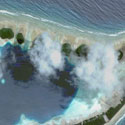
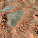
…which leads me to today’s blog. Recently, I was doing field work in the Boundary Waters area of northern Minnesota. Without a doubt, the Boundary Waters is the most lovely mosquito and wood tick hatchery in the lower 48. But I digress. Our fearless field party got lost under my direction. After a while, all the ponds and mossy outcrops look the same. In desperation, I sent one of the folks (we will call him “CyberKnife”) back to the car to dig up my ToughBook and GPS receiver. I popped up Google Earth though we did not have an internet connection and was amazed by how much detail was stored in the cache. Years ago, I would use the program ExpertGPS for mapping because it had a deep cache, and I still find the program fantastic for flat, back maps and airphotos. I haven’t used Google Earth in the field because I didn’t think it would work. Well, it worked fantastic! The only issue was that the COM port assigned to the GPS was too high for Google Earth so that will need to be addressed.
OK, so what to use for collecting data in the field? The industry standard is still dominated by ESRI and ArcPad is there solution for data collecting. If you have a PC and want to plot lines or points on topo maps, I am still a fan of National Geographic TOPO. Need road, airphotos, and other layers? Well, jump on the Google Earth bandwagon. Once MapWindow allows for higher COM port numbers, I’ll recommend MapWindow for all ‘real’ GIS needs in the field.
(*As long as I can claim some bandwidth on the global web, I’d like to wish my pal Brian and the rest of the GIS crew on the edge of the northern California fires good luck. Soot-covered fireman get all the thanks on the local radio, but there are lots of other folks working long shifts behind the scenes.)